How high is Slieve Donard?
Slieve Donard is Northern Ireland’s highest mountain. The National Trust gives 852 metres; some official tourism material gives 850 metres. “About 850 metres” is a sensible overview, while the exact figure should be read with its source. This guide does not resolve a survey difference by pretending the sources agree.
Summit height is an elevation above sea level, not the exact amount you will climb. Your total ascent depends on the route and any additional ups and downs. For the classic outing, use the published Glen River return distance and terrain, rather than turning summit height into a walking-time calculation.
What to notice when you arrive.
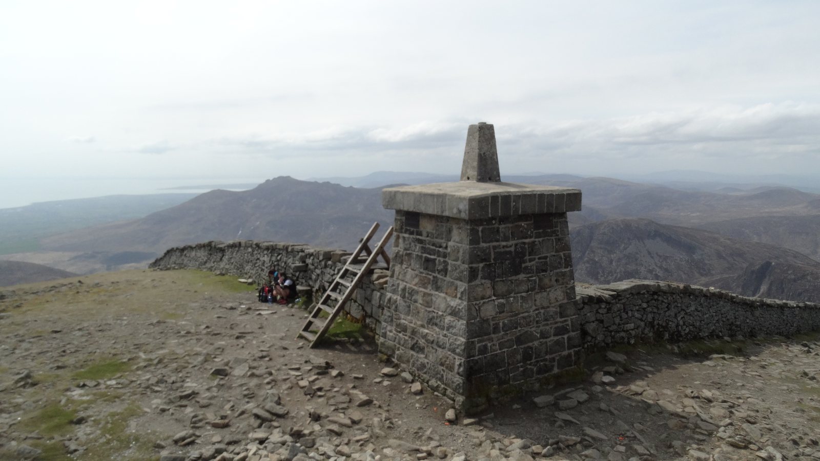
Look first at the immediate place: granite, the Wall and the summit remains. The Great and Lesser Cairns are archaeological monuments from different prehistoric periods, with later changes associated with survey and construction. Leave the stones undisturbed and avoid climbing on the remains.
The history guide puts those layers in order. It is worth reading beforehand, so that a summit stop can be about noticing what is there rather than searching a phone for explanations while you cool down.
A view is a bonus, not a promise.
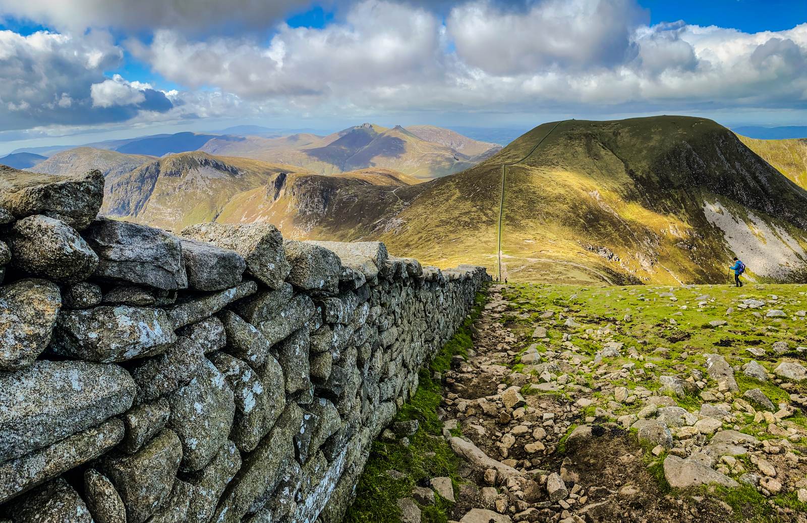
When visibility permits, the top offers a broad sense of the Mourne landscape and its relationship to the coast. The Wall descending towards neighbouring Commedagh is one of the most recognisable nearby scenes. Newcastle below connects the high ground with the sea-level beginning of the day.
Cloud can remove that context very quickly. Do not walk towards an edge to try to get below it, and do not use a distant shape as your only navigation reference. The Glen River route advice specifically highlights the Eagle Rocks cliffs on the northern side. Stay well back from exposed edges.
The photograph at the top of this page is a view from Donard towards Commedagh. The large mountain in that image is not Donard itself. All photographs are earlier observations, not live visibility or ground reports.
Use the stop well.
Put on warmth before you become cold, find an appropriate place to pause away from edges, and keep the group together. Eat and drink if needed. Check the remaining daylight, the group’s condition and the return route while people can still concentrate on the decision.
There is no need to wait for a photograph if wind or cold makes stopping uncomfortable. A quick, deliberate departure is often more useful than trying to recreate someone else’s summit picture. Leave the place tidy and take everything you brought.
The important next landmark is the right descent.
For the classic Glen River return, descend beside the Wall to the Donard–Commedagh saddle, then take the planned valley approach back to the woodland and Donard Park. Confirm that transition on your map. The Wall continues across a much wider landscape and should not be followed indefinitely as though it were a sign to Newcastle.
Leave yourself time to descend carefully on tired legs. Regroup before the valley turn, keep food and layers accessible, and avoid inventing a shortcut towards the town. Read the descent stage and make a return plan before the climb.
Sources & review notes
Editorial research reviewed 16 October 2026. These are source observations, not a live conditions report. Photographs have separate credits and dates.
Editorial review: 16 October 2026 · How we use sources