A woodland beginning. A mountain finish.
The Glen River approach brings several quite different walks into one day. You begin among trees and moving water, reach an open valley, meet the long granite boundary of the Mourne Wall, then face the steep climb to the summit. The return retraces that sequence. Thinking in stages helps you judge the day without treating the top as an obligation.
Use this guide to understand the walk. Carry a suitable map and know how to use it. These descriptions are orientation, not turn-by-turn navigation or a report of today’s conditions.
- Published route
- Slieve Donard via Glen River
- Start and finish
- Donard Park, Newcastle
- Distance for planning
- About 9 km there and back — see source notes below
- Difficulty
- Strenuous mountain walking
- Shape
- Out and back, with a steep final ascent
The official tourism route listing gives 2.9 miles one way; its Mourne overview describes about 4.6 km to the summit. Retracing that approach implies roughly 9 km for the whole day. This is a planning conversion from those published one-way figures, not a newly measured track.
Other publisher measurements differ: OutmoreNI’s Glen River listing gives 3.5 miles and labels the route linear, while its description includes returning by the same approach. Those figures and labels do not establish one agreed total. Check the exact publisher map you intend to follow, include any walk from parking or transport, and allow a margin. Your recording can differ with path choices and detours. Popularity does not remove the rough ground and substantial climbing.
Read the WalkNI route description and map alongside this guide, then check preparation and suitability. Do not use a social-media track or this page as your only means of navigation.
How long should you allow?
The official regional tourism Mourne Mountains overview describes roughly six hours at a leisurely pace, or around four for experienced walkers for the walk up and down Donard. Treat that as broad planning guidance for the outing, rather than a target or a guaranteed finish time. A long photo stop, a slow descent, wind, wet stones or a tired group can change the day substantially.
Work backwards from the daylight and your actual return transport. Choose a turnaround time before you start, leaving a margin for the descent. Check progress as a group: a strong walker reaching a landmark quickly tells you little about whether everyone has enough energy to come back comfortably. A summit time from an app is especially unhelpful if it excludes rests or the return.
Use the linked Mourne overview for that published timing context; the separate route listing does not give a duration. Make a day checklist before setting off.
The climb, stage by stage.
These eight stages explain the changes in the landscape and the decisions they bring. They are not timed checkpoints. The photographs show the place on earlier days, not the state of a path or river now.
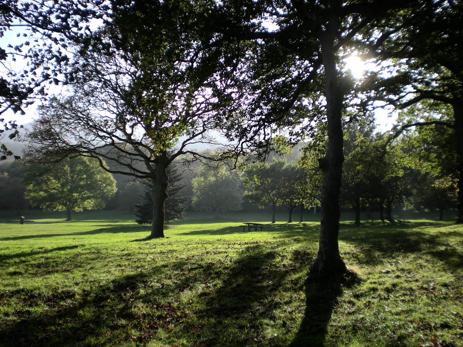
Donard Park & the woodland
Begin at the Donard Park start used by the published route, at the southern end of Newcastle. Before leaving, settle the small practical things: footwear, layers, water, the route on your map, and who has the return plan. Follow the current entrance and access signs rather than assuming every track from the park goes the same way.
The wooded lower section feels sheltered compared with the mountain above. Enjoy that change of pace, but do not use the weather here to decide what the summit will feel like. For a shorter outing, the lower woodland can be a destination in its own right; choose a suitable signed route and a deliberate return point.
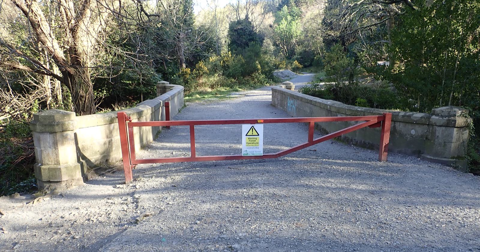
The Glen River & its bridges
The river gives the early walk its character: water over stone, changing views through the trees, and bridges that mark progress without needing to watch a distance counter. Keep your route description handy through the woodland network. The sound of the water is a companion, not a complete navigation instruction.
Wet rocks and edges deserve attention even when the climb feels straightforward. Give other walkers room at narrow places, supervise children near water, and avoid edging onto riverbanks for a photograph. A bridge in a picture is a landmark to recognise, not proof of the exact crossing you should use today.
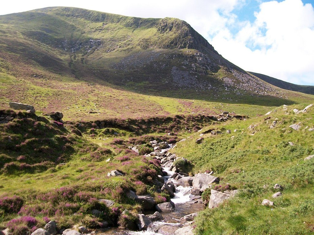
Out of the trees, into the valley
As the trees fall behind, the scale changes. The Glen River valley draws the eye towards the higher ground between Donard and Commedagh. You are moving from a sheltered beginning into open mountain terrain. Wind and visibility can feel very different here.
This is a useful moment to add or remove a layer, eat something and compare the group’s progress with the plan. Keep to the established path where possible. Walking around soft ground can widen damage across the hillside; do not make a fresh shortcut simply because it looks drier. If the conditions or energy levels are deteriorating, turning here can still make a satisfying day.
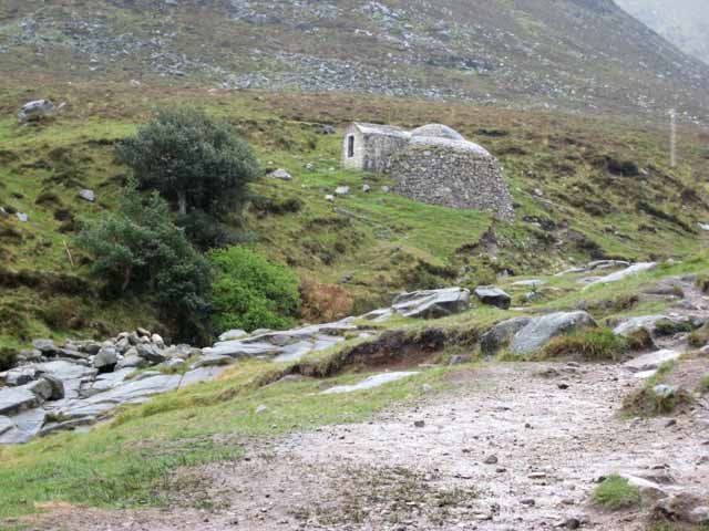
The old ice house
The small domed building above the Glen River is easy to mistake for a mountain shelter. It is a nineteenth-century ice house associated with the former Donard Lodge: a reminder that this valley once served an estate as well as passing walkers. Granite walls and a brick dome helped make a cold store before electric refrigeration.
Look at its shape and position from the established approach. Do not treat a heritage structure as a shelter, climb on it, or assume its interior is open. The ice-house story explains what is documented and why this guide uses a broad date rather than a disputed precise year.
The saddle & the Mourne Wall
The saddle between Donard and Commedagh is the transition from the valley approach to the last climb. Meeting the Wall can feel like arriving somewhere; it is also a good place to reassess what remains. The summit is still above you, and every metre climbed must be descended again.
Check your map, visibility, time and the whole group’s condition before continuing. Do not add Commedagh just because it is nearby on the skyline. That would be a different mountain plan, with extra climbing and route decisions. If you choose to return, identify the correct Glen River descent from your map rather than following whichever walkers leave first.
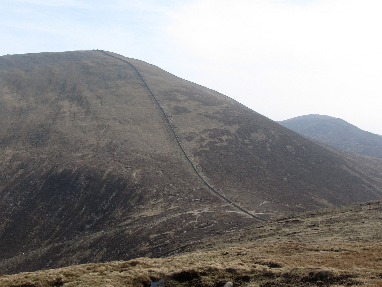
The steep pull beside the Wall
The final ascent beside the Mourne Wall is the most sustained steep part of the classic approach. Set a pace that leaves you able to come down with care. Breaks are useful; so is noticing whether the wind is strengthening or cloud is obscuring the ground ahead.
The Wall is an unmistakable feature, but it is not a substitute for navigation. Stay well clear of the Eagle Rocks cliffs on the northern side, highlighted in the published route advice. Avoid drifting towards an edge for a view or photograph. In snow, ice or poor visibility, the familiar summer outing becomes a very different undertaking.
The summit: more than a finish line
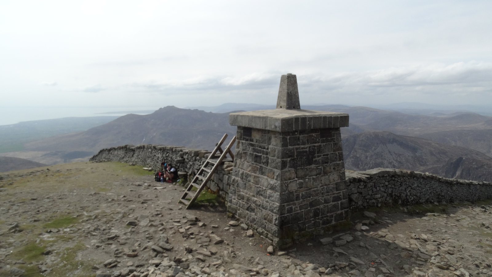
At the top, notice the relationship between the Wall, the cairns and the surrounding mountains. The cairns are prehistoric monuments, later affected by survey and construction, rather than a supply of loose stones for visitors to rearrange. Leave them undisturbed.
Views depend on visibility. You do not need a panorama to have reached an interesting place, and you do not need to stay if the conditions make resting uncomfortable. Add warmth before you cool down, eat or drink as needed, and confirm the return route while everyone is together. Read what to notice at the summit before the trip.
Return through the Glen River valley
Retrace the planned Glen River approach: from the summit beside the Wall to the saddle, then back down the valley and through the woodland to Donard Park. Confirm the turn from the Wall into the correct valley. A wall that continues across the mountains is not a continuous instruction to your car.
Take the descent seriously. Tired legs and damp stones can make it slower than expected. Keep the group together and allow pauses before concentration slips. Do not make up a new way down to save time. Back in the trees, check the last part to your actual meeting point; finishing the mountain section does not remove the need to navigate the woodland paths.
Is this the route for your day?
For a first visit centred on Donard, the Glen River return is the clearest route to research here: one published start, a recognisable sequence of landscapes, and the same approach home. “Classic” does not mean easy, waymarked throughout or suitable in every condition.
Bloody Bridge is a different approach from the coast south of Newcastle. It is not a shortcut to substitute halfway through a Glen River plan, and a point-to-point outing needs return transport arranged in advance. This guide does not assign an unsupported alternative distance or time. Use an authoritative route description and suitable mapping for the exact outing you choose.
For a mixed group, a lower woodland outing or a Newcastle seafront day can be a better choice than splitting people between an unplanned summit push and a long wait. For broader alternatives, compare the Mourne Guide walks, then read the exact route’s terrain and access information.
Questions before the climb.
Do you need to scramble?
The published Glen River description is a strenuous walking route rather than a technical climbing itinerary. That does not remove rough or steep ground, difficult weather or the need to use your hands for balance in places. If your group needs a smooth, level or step-free outing, choose something else.
Can a beginner climb Slieve Donard?
Some people make it their first mountain, but “beginner” says nothing about fitness, equipment, weather judgement or navigation. Assess those separately. A guided outing or a smaller first walk may be a better way to build confidence. See suitability and group decisions.
Is the route open today?
This page is not a live access report. Check the National Trust’s current visitor information, the published route notices and signs at the start. A historic repair or a recent photograph does not establish today’s access.
Sources & review notes
Editorial research reviewed 16 October 2026. These are source observations, not a live conditions report. Photographs have separate credits and dates.
- WalkNI — Slieve Donard via Glen River
- OutmoreNI — Glen River route and terrain
- Official regional tourism — Glen River route
- Official regional tourism — Donard timing and one-way distance
- National Trust — current Mournes visitor information
- National Trust heritage record — Donard ice house
- National Trust — history of Slieve Donard
Editorial review: 16 October 2026 · How we use sources